Code Monkey home page Code Monkey logo

cedar's Introduction

@esri/cedar

Build Status

JavaScript Charts for ArcGIS

cedar

Cedar is a library for crafting and sharing data visualizations that:

  • are powered by data from ArcGIS maps, scenes, and services
  • include smart default visualization choices
  • can be customized to meet your specific needs

See below for how to get started, understand cedar's core concepts, or see demos of cedar in action.

You are looking at the documentation for v1.x of cedar. You can also view the documentation for v0.x of cedar.

Getting Started

Installing Cedar

NOTE: If you want to use cedar in an Ember.js application, see ember-cli-cedar instead.

You can install cedar and its dependencies with npm:

npm install --save @esri/arcgis-rest-feature-layer@^2.0.0 @esri/arcgis-rest-request@^2.0.0 amcharts3 @esri/cedar 

or yarn:

yarn add @esri/arcgis-rest-feature-layer@^2.0.0 @esri/arcgis-rest-request@^2.0.0 amcharts3 @esri/cedar

Alternatively, you can get cedar from the unpkg.com CDN as shown below.

Importing Cedar

If you're using Cedar in a modern web application built with a bundler like webpack, you can load Cedar and its dependencies using import statements.

// import the amCharts base library
import "amcharts3/amcharts/amcharts";
// in this case, we only need bar charts, so we'll import the appropriate amCharts module
import "amcharts3/amcharts/serial";
// optionally import an amcharts theme; cedar provides a calcite theme
import "@esri/cedar/dist/umd/themes/amCharts/calcite.js";
// import the cedar Chart class
import { Chart } from "@esri/cedar"

If you need to use other chart types, or want to use amCharts plugins, import the appropriate amCharts modules before importing cedar:

// for pie charts
import "amcharts3/amcharts/pie";
// for scatter and bubble charts
import "amcharts3/amcharts/xy";
// for radar charts
import "amcharts3/amcharts/radar";

See the amCharts documentation for more information on importing amCharts modules.

Using Cedar

Once cedar is loaded you can create and show the chart at a designated element. First create the element:

<div id="chart" style="height: 400px;"></div>

Then add a script that will configure cedar and render the chart:

// connect to the data
var datasets = [{
  "url": "https://services.arcgis.com/uDTUpUPbk8X8mXwl/arcgis/rest/services/Public_Schools_in_Onondaga_County/FeatureServer/0",
  "name": "schools",
  "query": {
    "orderByFields": "Number_of_SUM DESC",
    "groupByFieldsForStatistics": "Type",
    "outStatistics": [{
      "statisticType": "sum",
      "onStatisticField": "Number_of",
      "outStatisticFieldName": "Number_of_SUM"
    }]
  }
}];

// designate a one or more series to show the data on the chart
var series = [{
  "category": {"field": "Type", "label": "Type"},
  "value": {"field": "Number_of_SUM", "label": "Number of Students"},
  "source": "schools"
}];

// optionally override any of the cart type's default styles
var overrides = {
  "categoryAxis": {
    "labelRotation": -45
  }
}

//create a cedar chart using the known 'bar' type
var elementId = 'chart';
// NOTE: the following line assumes you've imported Chart like:
// import { Chart } from "@esri/cedar";
// if you've loaded the Cedar using script tags
// and are using the cedar global instead
// you should replace this line with:
// var chart = new cedar.Chart(elementId, {"type": "bar"}) 
var chart = new Chart(elementId, {"type": "bar"})
  .datasets(datasets)
  .series(series)
  .overrides(overrides);

// render the chart
chart.show();

See the API documentation for further details on how to work with cedar charts.

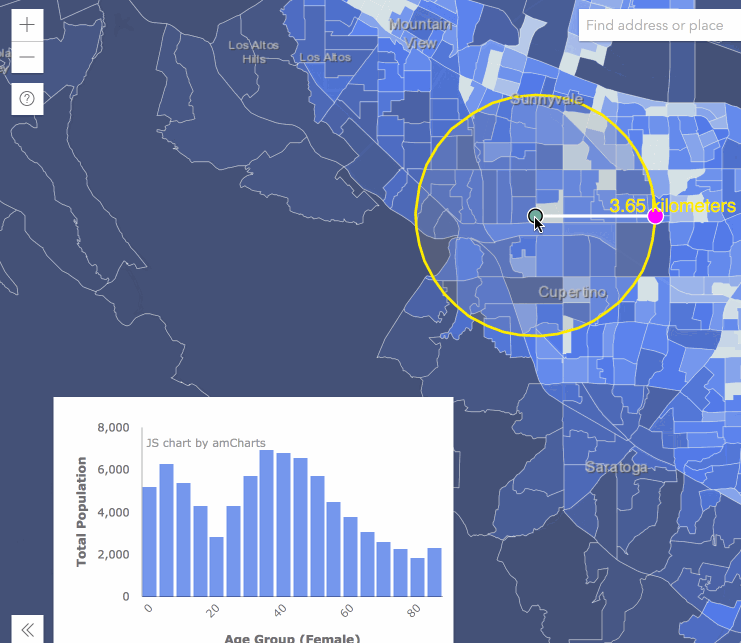
See the Demos section below for examples of Cedar working with other libraries like ArcGIS API for JavaScript or React.

Configuring Cedar

You can configure cedar to use a custom implementation of fetch() by setting cedar.config.fetch = myCustomFetch.

Concepts

Components of a Cedar Chart

Cedar charts are built from a definition, which consists of:

  • an array of datasets, each has either:
  • an array of series that bind that data to the plots (bars, lines, points, etc) on the chart
  • and overrides that are specific modifications to the chart type's default styles

Types of Charts

Cedar currently provides a set of commonly used chart types including bar, line, area, scatter, bubble, pie, and radar. In the future it will be possible for developers to create custom charts types that can be used by other developers with their own data sources.

Presentations

Charts and Custom Visualizations Beyond the Map

Slides from the 2018 DevSummit

Video from the 2017 DevSummit

Demos

See this code pen to try creating a simple bar chart like the one above.

You can then see and modify the definitions for different types of charts.

You can also see how to use cedar with the ArcGIS API for JavaScript in these examples:

See this CodeSandbox for an example of how to use Cedar in React.

Loading Cedar

Instead of installing and importing Cedar, you can load Cedar and its dependencies by including script tags that point to the CDN (or your locally installed versions of these libraries). This will make the cedar global available to your application.

From a CDN

<!-- load the amCharts base library -->
<script src="https://www.amcharts.com/lib/3/amcharts.js"></script>
<!-- in this case, we only need bar charts, so we'll load the appropriate amCharts script -->
<script src="https://www.amcharts.com/lib/3/serial.js"></script>
<!-- load the arcgis-rest-js scripts -->
<script src="https://unpkg.com/@esri/arcgis-rest-request"></script>
<script src="https://unpkg.com/@esri/arcgis-rest-feature-layer"></script>
<!-- optionally load an amcharts theme; cedar provides a calcite theme -->
<script src="https://unpkg.com/@esri/cedar/dist/umd/themes/amCharts/calcite.js"></script>
<!-- load cedar -->
<script src="https://unpkg.com/@esri/cedar/dist/umd/cedar.js"></script>

If you need to use other chart types, or want to use amCharts plugins, load the appropriate amCharts scripts before loading cedar:

<!-- for pie charts -->
<script src="https://www.amcharts.com/lib/3/pie.js"></script>
<!-- for scatter and bubble charts -->
<script src="https://www.amcharts.com/lib/3/xy.js"></script>
<!-- for radar charts -->
<script src="https://www.amcharts.com/lib/3/radar.js"></script>
<!-- optioinally load the amcharts plugin to export the chart as and image or table -->
<script src="https://www.amcharts.com/lib/3/plugins/export/export.min.js"></script>
<link rel="stylesheet" href="https://www.amcharts.com/lib/3/plugins/export/export.css" type="text/css" media="all" />

Dependencies

Cedar isn't yet another JavaScript charting library. Instead, cedar is a very thin wrapper around other libraries that do the heavy lifting. Cedar uses amCharts library as its charting engine. Cedar also uses @esri/arcgis-rest-feature-layer and @esri/arcgis-rest-request to query feature data. You will need to install these libraries along with cedar in your application. If you are loading cedar from a CDN, please refer to the loading cedar section above for the <script> tags that you will need to include.

Cedar supports the same browsers as ArcGIS Online, however you may need to include polyfills for fetch and Promise, if your application has to support browers that don't support them (i.e. IE or older versions of Safari/Android).

Versioning

For transparency into the release cycle and in striving to maintain backward compatibility, Cedar is maintained under the Semantic Versioning guidelines and will adhere to these rules whenever possible.

Releases will be numbered with the following format:

<major>.<minor>.<patch>

And constructed with the following guidelines:

  • Breaking backward compatibility bumps the major while resetting minor and patch
  • New additions without breaking backward compatibility bumps the minor while resetting the patch
  • Bug fixes and misc changes bumps only the patch

For more information on SemVer, please visit http://semver.org/.

Development Instructions

This repository is a monorepo managed using yarn workspaces and lerna

  1. Fork this repository and clone 'cedar' locally
  2. cd into the cedar folder
  3. Install the dependencies and initialize the monorepo with yarn
  4. to run the docs site locally, start a web server at the root folder and visit /docs
  5. to rebuild the script files used by the docs page whenever the source code is updated, run yarn start

Tests

To run tests one time for all packages, run yarn test from the monorepo root.

To run tests for any package as you update its source code, cd into that package and run yarn run test:watch to continually run that package's tests as you make your changes.

Licensing

Copyright © 2014-2018 Esri

Licensed under the Apache License, Version 2.0 (the "License"); you may not use this file except in compliance with the License. You may obtain a copy of the License at

http://www.apache.org/licenses/LICENSE-2.0

Unless required by applicable law or agreed to in writing, software distributed under the License is distributed on an "AS IS" BASIS, WITHOUT WARRANTIES OR CONDITIONS OF ANY KIND, either express or implied. See the License for the specific language governing permissions and limitations under the License.

A copy of the license is available in the repository's LICENSE file.

cedar's People

Contributors

ajturner avatar andygarfield avatar apfister avatar benheb avatar benstoltz avatar chelm avatar dbouwman avatar drewlevitt avatar goldenlimit avatar heikoh avatar jgravois avatar markhamshofner avatar tomwayson avatar

Stargazers

 avatar  avatar  avatar  avatar  avatar  avatar  avatar  avatar  avatar  avatar  avatar  avatar  avatar  avatar  avatar  avatar  avatar  avatar  avatar  avatar  avatar  avatar  avatar  avatar  avatar  avatar  avatar  avatar  avatar  avatar  avatar  avatar  avatar  avatar  avatar  avatar  avatar  avatar  avatar  avatar  avatar  avatar  avatar  avatar  avatar  avatar  avatar  avatar  avatar  avatar  avatar  avatar  avatar  avatar  avatar  avatar  avatar  avatar  avatar  avatar  avatar  avatar  avatar  avatar  avatar  avatar  avatar  avatar  avatar  avatar  avatar  avatar  avatar  avatar  avatar  avatar  avatar  avatar  avatar  avatar  avatar  avatar  avatar  avatar  avatar  avatar  avatar  avatar  avatar  avatar  avatar  avatar  avatar  avatar  avatar  avatar  avatar  avatar  avatar  avatar

Watchers

 avatar  avatar  avatar  avatar  avatar  avatar  avatar  avatar  avatar  avatar  avatar  avatar  avatar  avatar  avatar  avatar  avatar  avatar  avatar  avatar  avatar  avatar  avatar  avatar  avatar  avatar  avatar  avatar  avatar  avatar  avatar  avatar  avatar  avatar  avatar  avatar  avatar  avatar  avatar  avatar  avatar  avatar  avatar  avatar  avatar  avatar  avatar  avatar  avatar  avatar  avatar  avatar  avatar  avatar  avatar  avatar  avatar  avatar  avatar

cedar's Issues

Sizing Issues on chart frame

There seems to be another open issue related to sizing/responsiveness but this one slightly different.

I took this default basic scatter.json and changed width/height to the values I needed (555px by 555px in this case). The chart got renderer in 809 x 615 box:
image

This issue is not specific to scatter plot, it is also reproducible for bar chart (the size discrepancy for bar chart is much less notable).

Please use this feature server to repro:
http://services.arcgis.com/pmcEyn9tLWCoX7Dm/arcgis/rest/services/CA_Hospitals/FeatureServer/0
... and use Mortality_Readm_Rate as X and Number_of_Patients as Y.

Cedar Workflow and API

This is a general issue for thrashing out the Cedar API

There are 2 types of json documents involved with cedar.

Cedar Templates

These are the source, generic templates, based on the vega spec syntax, with an inputs hash appended.

An example of this would be json describing a generic bar chart - aka bar-chart.json

Stored in portals as type: chart-template

Cedar Chart

This is the combination of a vega spec, with the data source url / embedded data. This is the most commonly consumed form for presentation to the end-user.

An example of this would be dc-bar-chart-of-crimes-by-type-over-the-last-month.json.

Stored in portal as type: chart

API Philosophy

  • templates/data can be fetched by cedar, but also may be passed in to avoid additional round-trips.

API Dependencies

  • vega - for the visualization grammar and parsing into d3 based charts
  • d3 because vega depends on it and also used to fetch data

Public API

moved to http://esridc.github.io/cedar/api-reference/

Option to capture and store query response as property of Cedar object.

Would be nice to have the option of storing the query response to save an additional request.

Use case:
For story maps, we might like to drive the map interaction based on the chart. Present the user with a chart, zoom to feature with greatest value. Update chart with new query, zoom to new feature with greatest value.

Cedar Out-Bound Events

As a developer I want to react to events on the chart so I can orchestrate the rest of my application

Examples

dc school scatter plot - mouse over the graph, see the point on the map light up
dc school enrollment by type bar chart - move over graph, see schools of that type light up

Events

  • mouse over, mouse out, click, double click
  • objects to listen to: chart content, axes(?), legend(?)

Notes

vega views expose a nice eventing api via .on(, callbackfct), however, the event that is returned has a whole mess of vega/d3 noise in addition to the actual data. While that may be useful to a small subset of developers, for Cedar we should return a simpler payload that relates back to the data, and omits the noise.

In order to do this, we would need to wrap the vega events, and raise our own events. This would not be difficult, and could be implemented as an optional module. We would likely lean on an existing micro library for this so we have a well tested fluent (aka .on() ) style api.

Add Properties to Cedar to hold state

This will allow for modification of a cedar object like...

//pseudo code
var cedar = new Cedar();
cedar.show('#chart", chartObject);
//modify the where clause
cedar.query.where = 'TOTAL_STUDENTS > 100';
//update the chart
cedar.update();

Support AMD

Currently, Cedar expects global vg variable but in presence of an AMD loader (e.g. Esri JS API), Vega defines itself as AMD module without creating global variables. Cedar fails to work in this scenario.

Suggestions for responsive charts

The responsive example is a good starting point, but it would be great if the Cedar API provided an option to indicate that the chart is responsive, and handled that so that the client code does not have to. I like the way that Chart.js does this with these two chart options:

    // Boolean - whether or not the chart should be responsive and resize when the browser does.
    responsive: false,

    // Boolean - whether to maintain the starting aspect ratio or not when responsive, if set to false, will take up entire container
    maintainAspectRatio: true,

If responsive is true, Chart.js will add a debounced handler for window resize that updates the chart height / width based on the new size of the chart's dom node the above maintainAspectRatio option.

I believe this can be done in Cedar b/c you get a reference to the chart's dom element in the .show() method. If the responsive option is truthy, you could add a debounced window resize event listener to call a new resize() method which would update the chart's width/height overrides based on the dom element's size and call update() just as in the example only instead of setting all the overrides, you'd only update the width and height overrides.

Thoughts?

Chart | Multiple lines

close, but needs more work

vega_live_editor

{
  "width": 700,
  "height": 400,
  "data": [
    {
      "name": "cars",
      "url": "http://opendata.arcgis.com/datasets/3979e158e3b941dbaac1227c4f0a200d_0/FeatureServer/0/query?where=1=1&outFields=*",
      "format": {
        "property": "features"
      }
    },
    {
      "name": "fields",
      "values": ["Q1 Actual", "Q2 Actual", "Q3 Actual", "Q4 Actual"]
    }
  ],
  "scales": [
    {
      "name": "ord",
      "type": "ordinal",
      "range": "width", "points": true,
      "domain": {"data": "fields", "field": "data"}
    },    
    {
      "name": "Q1 Actual",
      "range": "height", "zero": false, "nice": true,
      "domain": {"data": "cars", "field": "data.attributes['Q1 Actual']"}
    },
    {
      "name": "Q2 Actual",
      "range": "height", "zero": false, "nice": true,
      "domain": {"data": "cars", "field": "data.attributes['Q2 Actual']"}
    },
    {
      "name": "Q3 Actual",
      "range": "height", "zero": false, "nice": true,
      "domain": {"data": "cars", "field": "data.attributes['Q3 Actual']"}
    },
    {
      "name": "Q4 Actual",
      "range": "height", "zero": false, "nice": true,
      "domain": {"data": "cars", "field": "data.attributes['Q4 Actual']"}
    }
  ],
  "axes": [
    {"type":"y", "scale":"Q1 Actual",  "offset":{"scale":"ord", "value":"Q1 Actual"}},
    {"type":"y", "scale":"Q2 Actual",  "offset":{"scale":"ord", "value":"Q2 Actual"}},
    {"type":"y", "scale":"Q3 Actual",  "offset":{"scale":"ord", "value":"Q3 Actual"}},
    {"type":"y", "scale":"Q4 Actual",  "offset":{"scale":"ord", "value":"Q4 Actual"}}
  ],
  "marks": [
    {
      "type": "group",
      "from": {"data": "cars"},
      "marks": [
        {
          "type": "line",
          "from": {"data": "fields"},
          "properties": {
            "enter": {
              "x": {"scale": "ord", "field": "data"},
              "y": {"scale": {"field": "data"}, "group": "data.attributes", "field": "data"},
              "stroke": {"value": "steelblue"},
              "strokeWidth": {"value": 1},
              "strokeOpacity": {"value": 0.3}
            }
          }
        }
      ]
    },
    {
      "type": "text",
      "from": {"data": "fields"},
      "properties": {
        "enter": {
          "x": {"scale": "ord", "field": "data", "offset":-8},
          "y": {"group": "height", "offset": 6},
          "fontWeight": {"value": "bold"},
          "fill": {"value": "black"},
          "text": {"field": "data"},
          "align": {"value": "right"},
          "baseline": {"value": "top"}
        }
      }
    } 
  ]
}

Apply Defaults on Dataset

Right now the dataset hash is extended only when the query string is generated. However, this means that if the developer passes in a minimal dataset, then the query node will not be present.

Instead - set cedar._defiition.dataset to the default, and have the setter simply _.extend(current, new)

CDN Deployment

Looks like the only way to load Cedar right now is by copying it locally to my HTTP server

Fix Timeline Example

Something happened during the refactor related to #31 that broke the timeline example

Should look like
image

but looks like
image

Optional Inputs support default values

  "inputs": [
    {"name": "count", "type": ["numeric","string"], "required": true},
    {"name": "group", "type": ["string"], "required": false},
    {"name": "aggregate", "type": ["option"], "options": ["sum","avg"], "required": false, "default": "sum" },
    {"name": "label", "type": ["string"], "required": false, "default": "{group}"},
    {"name": "width", "type": ["numeric"], "required": false, "default": 400},
    {"name": "height", "type": ["numeric"], "required": false, "default": "{width}"}
  ],

Provide a way to get the actual count (instead of a sum) of a group by query

When I specify a dataset like this:

  var dataset = {
    "url":"http://sampleserver5.arcgisonline.com/ArcGIS/rest/services/LocalGovernment/CitizenRequests/FeatureServer/0",
    "mappings":{
      "group": {"field":"severity","label":"Severity"},
      "count": {"field":"OBJECTID","label":"Count"}
    }
  };

I'm expecting it to send a query w/ the following outStatistics to the service:

[{"statisticType":"count","onStatisticField":"OBJECTID","outStatisticFieldName":"OBJECTID_COUNT"}]

Instead it sends:

[{"statisticType":"sum","onStatisticField":"OBJECTID","outStatisticFieldName":"OBJECTID_SUM"}]

Which is what I would expect if I set mappings.sum instead of mappings.count.

Am I missing something? Is there another way to group by and get counts instead of sums for another field?

Proposed Cedar Chart Json

In working on the Cedar code, I need to create the expected json structure, and try to cover the following scenarios:

  • must contain all the information to render a chart
    • i.e. can be stored in AGO as an item or item data
  • but still allows
    • modifications to the query
    • modifications to the chart template (axes titles etc)
    • simple re-rendering via cedar.update()
    • a chart editor app (cypress) to change the data source and field mappings

A Little History...

The original "template" was just a vega spec w/ tokens.

{ ... spec template ...}

We then extended that to have an "inputs" array so editor apps have the info needed to create the mappings...

{  
  "inputs": [
      {"name": "x","type": ["numeric"],"required": true},
      {"name": "y","type": ["numeric"],"required": true},
      {"name": "color","type": ["string"],"required": true}
    ],
   ... spec template ...
}

At this point, we could call cedar.create(template, mappings, dataUrl) and get a "compiled" chart json object (aka a vega spec) back out. That object would then be passed to cedar.show(elementId, chartJson) and the chart would be rendered. Woot!

The problem with that workflow is that in the compilation to the "vega spec" we have lost the parameterization, and thus it is a "one way" process. Put another way, if all cedar has in it's internal state is the compiled chart, we have limited options to manipulate the chart (i.e. change query etc).

In order to make cedar more flexible, I'm proposing that the "compiled vega spec" is ephemeral, and created as needed from a chart definition json.(totally open to changing terminology here)

The process chain would go like this:

chartTemplate + mappings + dataSource ==> chartDefinition

The api would be like this:

//constructor options
var cedar = new Cedar({chartDefinition: chartDefintionObjOrUrl})
var cedar = new Cedar({chartTemplate: chartTemplateObjOrUrl, mappings:{...}, dataSource:{...})
var cedar = new Cedar(); //must set template, mappings & dataSource properties before .show()

//once cedar has a full definition we can
//render the chart into an element
cedar.show(elementId);

//event handlers as before using .on
cedar.on('click', function(data){...do things..});

//Manipulate State: the query string... 
//if we using a real (ES5.1+) property it would look like this
cedar.query.where = "FOO > 12";
cedar.update();

//we could also make it chainable by using getter/setter functions
//thus allowing modifications and calls to update inline
cedar.query.where( "FOO > 12").update();

//could also pass in data - i.e. data is loaded in the map
//so get it from the feature layer in the map and pass in 
cedar.dataSource.data(...array of features...).update();

//finally we can get the full definition back out
//thus allowing apps to store this where ever they want
var def = cedar.definition();

Examples of the Json formats:

//chart template
{
  "inputs":[... array of inputs...],
  "specTemplate":{ ... template of a vega spec ...}
}
//mappings hash relating a datasource to the inputs
//main change here is the addition of label. If not present
//during compilation, it will be set to the value of the field
{
    "x": {
        "field": "POPULATION_ENROLLED_2008",
        "label": "Enrollment 2008"
      }
}
//dataSource
{
 "url":"...url to service...",
 "query": {... json hash of query params}
 "data":[...optional array of features...]
}

combined become...

//chart definition
{
  "config":{
    "dataSource":{ ... dataSource hash ...},
    "mappings": { ...mappings hash...}
  },
  "template": {
     "inputs":[... array of inputs...],
     "specTemplate":{ ... template of a vega spec ...}
  }
}

In this way, we always have all the info to re-create the vega spec, and also allow the query, or template to be modified in any way.

Here is an example of a whole definition object w real values and some inline comments https://gist.github.com/3d5e4784e2dd941507d3

/cc @ajturner

As a develop I want the data in the chart to change in response to other actions on the page

Generalized from #12

I zoomed the map to this area. While it is useful to use the popup to query parts of the map,
I really want the chart to instantly tell me something about the data using this map’s extent.

Example: in Urban Observatory, I see three population density maps side by side, but I really want to
know how many people are represented, in total, for each map’s extent

Pseudo code

//assumes we have a map object
var self = this;
Cedar.show(chartObj, function(chart){
  self.chart = chart;
});

map.on('zoom-end', function(evt){
  self.chart.query.bbox = Cedar.extentToBbox(map.extent);
  self.chart.update();
})

Cedar Impact

So, the first part of this would be to hold the mappings in the compiled chart vs actually replacing them in the template.

The second part would be to expose the query as part of the chart, and the ability to call .update(queryParams)

Chart Template Inputs

The inputs define the required

{
  "inputs": [
    {"name": "count", "type": ["numeric","string"], "required": true},
    {"name": "group", "type": ["string"], "required": false},
    {"name": "data", "type": ["url"], "required": true}
  ],
"datasources":[

 ],

...other properties...

}

Compiled Chart Inputs have values stored

{
  "inputs": [
    {"name": "count", "type": ["numeric","string"], "required": true, "value":"ZIP_CODE"},
    {"name": "group", "type": ["string"], "required": false, "value":"TOTAL_STUD_SUM"},
    {"name": "data", "type": ["url"], "required": true, "value":"http://someservice.com/featureserver/2"}
  ],

...other properties...

}

Support Histograms

Histograms are almost like bar charts except X-axis will show numeric intervals with some predefined breaks (equal intervals, natural breaks, etc.).

The implementation could probably use getHistogram method from new JS API.

Simple chart explorer demo

Idea for a quick 'chart explorer' demo using Cedar + Vega

arcgis_open_data__chart_explorer

  1. Data can be link to Feature Layer, AGO ID for Service or Array of values
  2. Style can be URL to Vega JSON, AGO ID for 'Chart', or inline JSON
  3. Sum/Group are dynamically created based on Vega extensions for the required input values. Array of Fields like Feature Layer
  4. Save to Online pushes the styling as an Application with Data as the JSON
  5. Load from Online loads the instantiated Chart. but links to Style - so changing style, saving style and then loading from online shows the updated rendering.

/cc @dbouwman

Time chart mouseover/off events always show same data

I’ve wired up mouseover on the line chart (events are logged to the console), but it seems that no matter where I hover in the chart I see the same data:

http://tomwayson.github.io/cedar/examples/time-responsive-events.html

@dbouwman points out that this is b/c w/ line charts there is only one mark (the line) and that wille the data that cedar gets back from vega is includes all the points that make up the line, cedar is only passing the first one back to the client event handler. He also suggested that we might be able to figure out the value from the array of points based on the mouse x position, but that we're probably better off waiting for vega v2's improved "interactions."

I did start looking at the v2 examples. The index_chart example here: http://idl.cs.washington.edu/projects/reactive-vega/examples/editor/ shows how to declaratively capture the changes to mousemove. Near as I can tell it’s getting the date along the x-scale at the mouse.x position and then using that as the input to a transform on the data (see below for .json).

Anyway, I wonder if that approach (getting data from the scales instead of the underlying data) makes more sense for line charts and whether or not there's a v1 way to do it.

"signals": [
    {
      "name": "xPos",
      "init": 265,
      "streams": [{"type": "mousemove", "expr": "p.x", "scale": "x", "invert": "true"}]
    },
    {
      "name": "indexDate",
      "init": 1104566400000,
      "streams": [{"type": "xPos", "expr": "date(xPos)"}]
    }
  ],
  "data": [
    {
      "name": "stocks",
      "url": "data/stocks.csv",
      "format": {"type": "csv", "parse": {"price":"number", "date":"date"}}
    },
    {
      "name": "index",
      "source": "stocks",
      "transform": [{
        "type": "filter",
        "test": "d.date + 1296000000 >= indexDate && d.date - 1296000000 <= indexDate"
      }]
    },
    {
      "name": "indexified_stocks",
      "source": "stocks",
      "transform": [{
        "type": "zip",
        "with": "index",
        "as": "index_term",
        "key": "symbol",
        "withKey": "symbol",
        "default": {"price": 0}
      }, {
        "type": "formula",
        "field": "indexed_price",
        "expr": "d.index_term.price > 0 ? (d.price - d.index_term.price)/d.index_term.price : 0"
      }]
    }
  ...

Make Cedar a constructor

To address #13 and other requirements where the cedar chart should hold state, we need to re-work it to be an object, not just an object literal with functions.

Power User Wishlist: From Email

Nuno and I got together to put some thoughts down as use cases for charting. Our context includes product and projects such as Living Atlas (demographics, urban systems, landscape) and Urban Observatory.

Use case 1: “Map, talk to me” a.k.a. “extent popup"
I zoomed the map to this area. While it is useful to use the popup to query parts of the map, I really want the chart to instantly tell me something about the data using this map’s extent.

Example: in Urban Observatory, I see three population density maps side by side, but I really want to know how many people are represented, in total, for each map’s extent:

pop-dens

Bar Chart underneath each map showing
124,000 people 3.6 million people 231,000 people

The bar chart updates as map extent changes (zoom or pan)
If user pans away from content, chart shows something friendly, or disappears after showing a friendly message. No “NaN” or other cryptic messages.

Authoring note: The bar chart uses the popup’s chart definition to “clue in” to what the map author already knows is important. This is not the only way to define new charting options, but it is critical we leverage knowledge already expressed in good popups.

Use case 2: Add Context by Comparing
User is looking at a map of Utah. They have never been to Utah. They click on the map. They get back a comparative chart showing median household income for multiple goegraphies, in this case: the country, state, county, and ZIP code where they clicked.

This explicitly puts geographies into the chart, a key distinguishing characteristic of Esri software.

barchart

Note: it is also useful sometimes to enter a “fixed” value that appears in the chart as a reference point. Examples: a national average, 98.6 degrees, index = 100, or other “anchor” value.

Good example: Census Reporter http://censusreporter.org/ and its embeddable charts as in this news story: http://yorkandfig.com/

Use case 3: a map tip chart
For a defined chart, the user can move the mouse along the map and the chart self-updates, like a tooltip or maptip, based on the chart’s geographic definition (e.g. 1 mile ring, 10 minute drive, nearest facility, find similar). If no geographic analysis is defined, the map tip chart simply uses lat long, like a speedy popup that requires no click. (Like NY Times maps’ maptips, but with a smart chart associated).

Example where speedy tips are sexy but don’t help create knowledge:
http://projects.nytimes.com/census/2010/map

Bonus: let the user “hang on” to a chart in session, so that they can easily build a comparison side by side visually, not just in their head. So, as I move around the map, if I want it to “stick” just click. That allows a user to see pie charts side by side for example.

Single-chart variation: as the user clicks, build a column chart or line chart one record per click, so that the user is building a story (and its chart) as they go.

Use case 4: sketch n chart
User is looking at a map of their city. They want to sketch an area on the map. They draw a polygon, and a chart appears, summarizing the data for the area they sketched. They draw another polygon. The chart expands to include a second element that summarizes the data for the second polygon.

Use case 5: chart what I want, not just what the data has
When comparing multiple features, I should be able to aggregate two columns into a new column. For example, I want to see the combined total of households making between $0-$15,000 and $15,000-$30,000 in an area in order to understand who may need support services in an emergency situation. Why: currently the database schema dictates what can be mapped or charted. Sometimes the user needs to see charts based on simple arithmetic of the raw data.

Use case 6: chart across layers
Example: I have total population in 1990, 2000, 2010 and 2014. Each is in its own layer or service. I want to show a simple chart that depicts total population from each of these services, brought together as a line or bar chart.

Use case 7: show me key values
From the chart I can see some useful information. If I touch the chart, the map highlights some key values (e.g. Features with the min or max value, features in a particular class, etc)

Use case 8: Sync map and chart
The map’s legend can inform the chart’s definition. If the map legend for income has 5 breaks, use those breaks and colors in the chart.

If the user touches the chart, chart author can choose to configure the chart to “light up” those features on the map, using a selection indicator or heat map. Easy undo.

Highlighter mode: let the user apply a digital highlighter pen to the chart, the corresponding features on the map are highlighted. Eg. Highlight the steepest part of a race course.

Chart author can configure the chart allow the user to instantly apply a filter to the map by touching the chart. Easy undo.

If I combine chart groups on the chart, combine them on the map and its legend also

Observations about charting contexts

What can I use to author a chart?
From a web map in AGOL (leverages legend info, popup info, AGOL item description/summary/credits)
From a map layer in AGOL (leverages legend info, popup info, AGOL item description/summary/credits)
From a REST endpoint (leverages legend info, item description/summary/credits)

Where can the chart appear?
Charts can appear on the map, or be directed to appear elsewhere on the map app, or be embedded independent of a map (like the Census example above)

Smart Charting
If customer wants to add a chart to a map, it should work like smart maps. Meaning, these are the 2 charts that best fit the data, please select one, or chose other for more options.

Where charts work
It would be great if the charts were available on desktop and online.

Specification should support GeoServices roll-up parameters

The Specification should include how the input mappings will be used in the query roll-up. This is not always easy to infer.

For example, when making a bar chart - we may say the height is the single value of an attribute, or it may be grouped by a category, or it may be a histogram which needs to make multiple calls to get bins.

Clear Selection

There is a select method, but there is no way to clear selection. Something like clearSelection method would be very useful here. As a dirty workaround, I have to call update and then select new items via setTimeout(..., 200)

Recommend Projects

  • React photo React

    A declarative, efficient, and flexible JavaScript library for building user interfaces.

  • Vue.js photo Vue.js

    🖖 Vue.js is a progressive, incrementally-adoptable JavaScript framework for building UI on the web.

  • Typescript photo Typescript

    TypeScript is a superset of JavaScript that compiles to clean JavaScript output.

  • TensorFlow photo TensorFlow

    An Open Source Machine Learning Framework for Everyone

  • Django photo Django

    The Web framework for perfectionists with deadlines.

  • D3 photo D3

    Bring data to life with SVG, Canvas and HTML. 📊📈🎉

Recommend Topics

  • javascript

    JavaScript (JS) is a lightweight interpreted programming language with first-class functions.

  • web

    Some thing interesting about web. New door for the world.

  • server

    A server is a program made to process requests and deliver data to clients.

  • Machine learning

    Machine learning is a way of modeling and interpreting data that allows a piece of software to respond intelligently.

  • Game

    Some thing interesting about game, make everyone happy.

Recommend Org

  • Facebook photo Facebook

    We are working to build community through open source technology. NB: members must have two-factor auth.

  • Microsoft photo Microsoft

    Open source projects and samples from Microsoft.

  • Google photo Google

    Google ❤️ Open Source for everyone.

  • D3 photo D3

    Data-Driven Documents codes.