- download the source code and build a WAR file using Maven
mvn clean install
- copy the created WAR file into tomcat_dir/webapps directory
- start tomcat
- create a database and install PostGIS
  createdb geofuse
  psql -c "CREATE EXTENSION postgis" geofuse
  psql -c "CREATE EXTENSION postgis_topology" geofuse
- create the schemas that will contain the dummy and metadata tables found in createtabs.sql
psql -f createtabs.sql geofuse
- create the deltemp function that will delete the temporary files
psql -f deltemp.sql geofuse
- add map layers (polygons/lines/points) which will later be used for thematics. it will be best to place the table into the created "geodata" schema.
-
Create a Workspace named
geofuse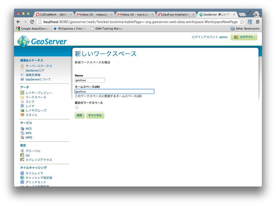
-
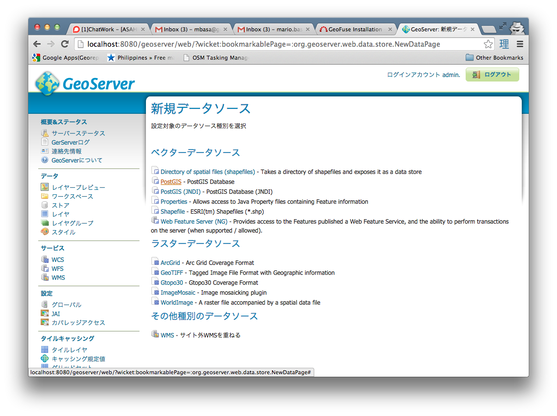
Create a new PostGIS DataStore
-
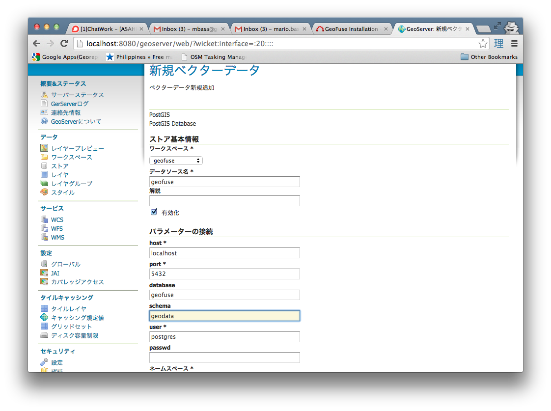
Name the new Store as geofuse and set the database parameter to the geofuse database created. Set the schema parameter to geodata
-
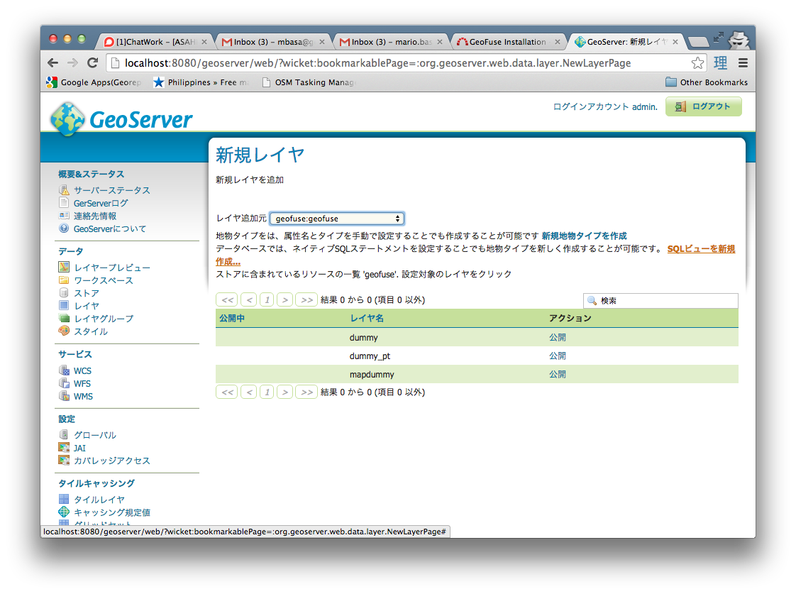
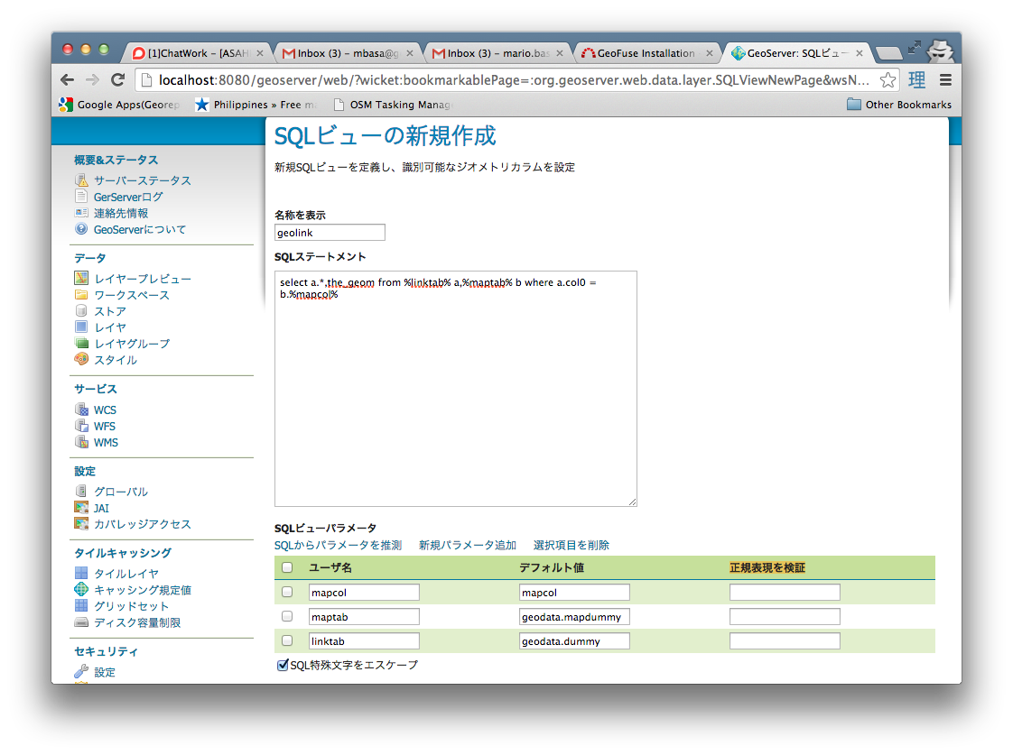
Create a new SQL View Layer
-
Set the layer name as geolink and the SQL Statement as
select a.*,the_geom from %linktab% a,%maptab% b where a.col0 = b.%mapcol%- Set the View Parameters to the values below and erase the values of the Validation regular expression (正規表現を検証)
  linktab = geodata.dummy
  maptab  = geodata.mapdummy
  mapcol  = mapcol
-
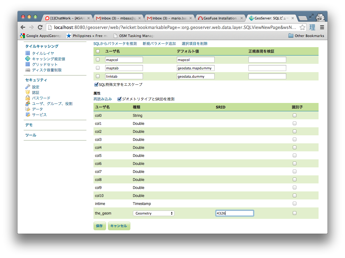
Press the Refresh button to update the Columns list. Change the SRID of the the_geom column to 4326 and press the Save Button.
-
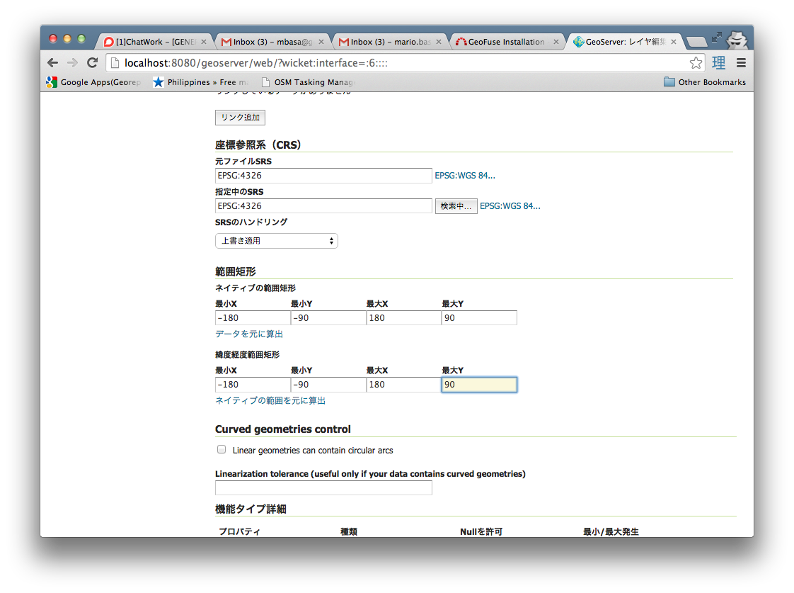
After Pressing the Save button, set the Bounding Box Parameters to -180 -90 180 90 in the main layer creation page and then Save.
-
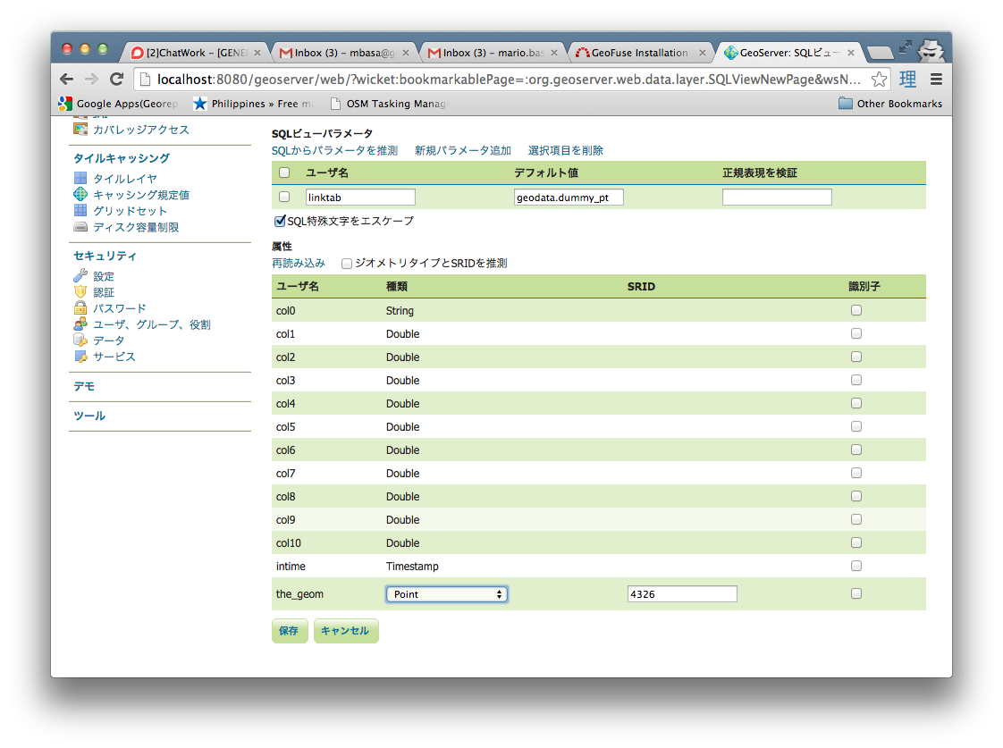
Create another SQL View Layer using the procedure set above. Set the layer name as geolink_pt and the SQL Statement as below
select * from %linktab%- Set the View Parameters to the values below and erase the values of the Validation regular expression (正規表現を検証)
linktab = geodata.dummy_pt
-
Press the Refresh button to update the Columns list. Change the Geometry Type to Point and the SRID of the the_geom column to 4326 and press the Save Button.
-
After Pressing the Save button, set the Bounding Box Parameters to -180 -90 180 90 in the main layer creation page and then Save.
Insert the following for each map layer that will be used to create thematic
- link colunm (i.e. 'prefocode)
- Map table name with schema (i.e. 'geodata.prefectures')
- created geoserver view name (i.e. 'geofuse:geolink')
- type of layer (i.e. 'polygon'))
insert into geofuse.maplinker values ('prefcode', 'geodata.prefecture', 'geofuse:geolink', 'polygon');In your browser, go to http://localhost:8080/geofuse/
NOTE: This application will try to get only metric (numeric) fields to display in the Thematic attribute list. For numeric ID fileds (i.e. Prefecture-ID,Country-ID,etc.), add a suffix "-ID" to the fieldname so that it will not show in the attribute list.
  tomcat_dir/webapps/GeoFuse/classes/properties/
      database.propertiess
      thematic.properties
Adding new postgis table
Adding new background layer for printing
Adding new colorscheme
/webapps/geothematics/WEB-INF/classes/properties/thematic.properties
NOTE: the ColorNames and Colors should have equal number of items, otherwise no color choices will appear in the Colors list of the web page.
Released under GPL.


