CTGAS is a software that produces terrain data to be served primarily for CesiumJS library.
CTGAS is written in Javascript just like Cesium itself. Cross platform and easy to install and use. As much as it is usable, there are lots of things to do so the source will be pending until it is ready to be released.
You can preview live demo HERE
You can get the source DEM data used for the showcase HERE
Comments and inputs are quite welcome. You can follow progress from issues and here
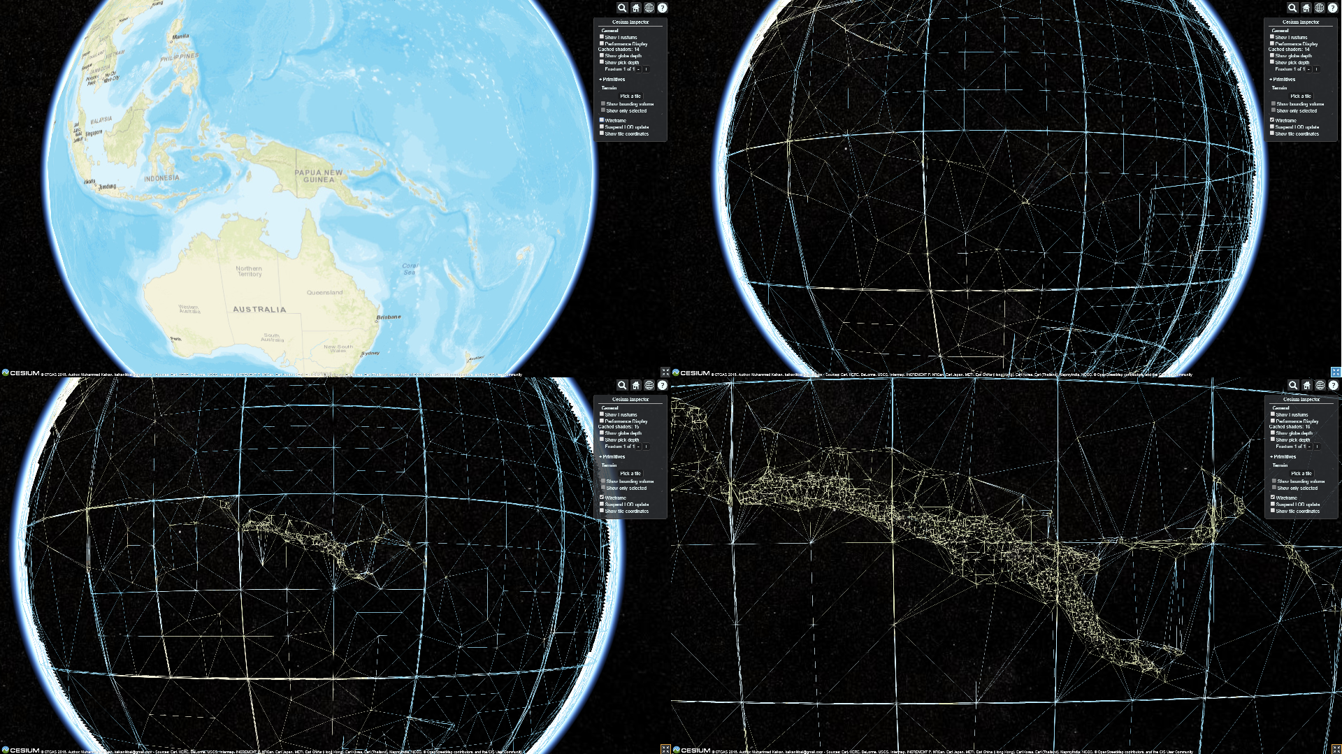
I have declared before that algorithm would change in future and i have been working on that for some time now. Development is still ongoing but i have decided to put it up online for a showcase demo. Since almost the entire software changed, there are features that need reimplementing such as multicore and data merge. After mesh generation is good enough to use these two will take turns. There are some flaws in generated terrain for now but hopefully it will come around.
Data source is same as before and can be downloaded from the link. TIF support is removed since i actually dont see any use for it.
Here are a few scenes that shows tile details. You can browse live demo from the link up.
CTGAS is usable at the moment as it is and have following features
- Heightmap format terrain tile generation
- Quantized Mesh format terrain tile generation
- KML format terrain tile generation
- Mesh Simplification Algorithm for tile generation
- Multicore tile generation support
- Tile Server in order to serve produced tiles
Cesium terrain server like mesh generation
- Extensions coding
- Interface to manage application
- Code refactoring
- Standalone server implementation
Java and C++ porting of the software can be easily done.


