![]()
![]()
![]()
Allows you to read the location from the GPS on your MKR GPS Shield.
This library is based on minmea.
For more information about this library please visit us at https://www.arduino.cc/en/Reference/ArduinoMKRGPS
MKRGPS Library for Arduino
License: GNU Lesser General Public License v2.1
![]()
![]()
![]()
Allows you to read the location from the GPS on your MKR GPS Shield.
This library is based on minmea.
For more information about this library please visit us at https://www.arduino.cc/en/Reference/ArduinoMKRGPS


![dependabot[bot] avatar](https://avatars.githubusercontent.com/in/29110?v=4 "dependabot[bot]")


MKR GSM 1400 with MKR GPS attached as a shield.
When using the MKR GPS example sketch, GPS data immediately appears in the serial monitor.
However, when using the following code to send GPS data to Arduino IoT hub, the GPS data never comes.
A connection to IoT cloud is made successfully but the function GPS.available() always returns 0.
#include <Arduino_MKRGPS.h>
#include <ArduinoIoTCloud.h>
#include <Arduino_ConnectionHandler.h>

#define THING_ID ""
#define BOARD_ID ""

const char GPRS_APN[]      = "";
const char PINNUMBER[]     = "";
const char GPRS_LOGIN[]    = "";
const char GPRS_PASSWORD[] = "";

float lat;
float lon;

GSMConnectionHandler ArduinoIoTPreferredConnection(PINNUMBER,GPRS_APN,GPRS_LOGIN, GPRS_PASSWORD);

void setup() {
  Serial.begin(9600);
  while(!Serial);

  if(!GPS.begin(GPS_MODE_SHIELD)){
    Serial.println("Failed to initialize GPS!");
    while(1);
  }else Serial.println("GPS Initilized OK!");

  initProperties();

  ArduinoCloud.begin(ArduinoIoTPreferredConnection);
  setDebugMessageLevel(4);
  ArduinoCloud.printDebugInfo();
}

void loop() {
  ArduinoCloud.update();
  delay(10000);

  if (GPS.available()){
    lat = GPS.latitude();
    lon = GPS.longitude();

    Serial.println("Latitude: " + String(lat));
    Serial.println("Longitude: " + String(lon));
  }
}

void initProperties(){
  ArduinoCloud.setThingId(THING_ID);
  ArduinoCloud.addProperty(lat, READ, ON_CHANGE);
  ArduinoCloud.addProperty(lon, READ, ON_CHANGE);
}Hi!
The chip used by this shield should be able to reach also 40-50km of altitude, but it is necessary to change its working mode.
If I'm not wrong, it should be the airborne mode, but the API of this library does not show how to do it.
Could you provide a snippet to set it? Is it possible to do it? Do you know which mode is set in the chip usually?
Thank you in advance!
Line 195 in c736985
The current version is "taking forever" to read a GPS location, if the user has a significant delay (e.g. 500ms) in the loop() method, since on each GPS.available() call only 1 byte is read.
proposed fix: replace the "if" with a "while" in line 195 (GPS.cpp)
Another tip: make the GPS_DEBUG flag available in the begin() method (2nd argument or so), to better track issues like this easily and without modifying the library.
I would like to ask the developers to add some simple functions:
a function for disable NMEA sentences and use the UBX protocol
I noticed that the library is already prepared for this.
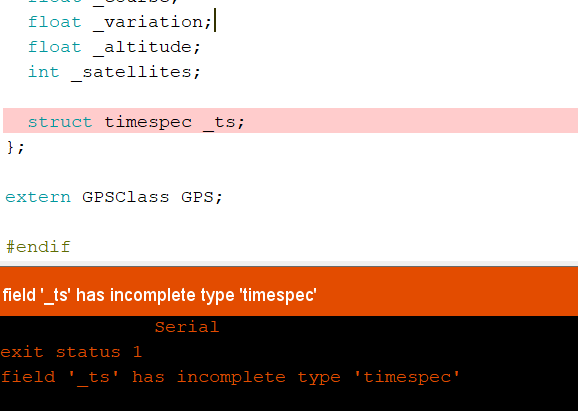
I downloaded the example GPSLocation.ino but when compiling it I get the following error: GPS.h:88:19: error: field '_ts' has incomplete type 'timespec' struct timespec _ts; In file included from sketch\GPS.cpp:23:0: sketch\minmea/minmea.h:214:27: note: forward declaration of 'struct timespec'
I'm using Arduino: 1.8.13
(Windows 10), Board: "Arduino Uno"
I would like to ask the developers to add some simple functions:
a function to use the geofence
I noticed that the library is already prepared for this.
Hey I am currently working on a tracking device with LiPo battery and BLE, I fount that if the device is not booted using the USB connected as serial port the GPS shield attacked to a Arduino MKR 1010 Wifi will not work. After hours of debugging I found that the problem was created by GPS.begin() , but if I use it as shield it won't crash:
if (!GPS.begin(GPS_MODE_SHIELD)) {
      Serial.println("Failed to initialize GPS!");
    while (1)
      ;
  }
Any ideas?
using together the two libraries with an arduino MKR WAN 1310 it happens that GPS.available () returns Always 0, how can this be solved?
See the code below, from this file:
size_t SerialDDC::write(uint8_t b)
{
  return write(&b, sizeof(b));
}

size_t SerialDDC::write(const uint8_t *buffer, size_t size)
{
  if (size < 2) {
    return 0;
  }

  ...
}
What's the purpose of the size < 2 test at the beginning of SerialDDC::write(const uint8_t, size_t)?
I tried to remove it and calling the method with only one byte, and indeed it doesn't work :-) Why?
Also, because of the above, method SerialDDC::write(uint8_t) always fails.
Has anyone tried the MKR-GPS with the PortentaH7 either using the MKR headers or the eslov connector?
I had similar issues with the MKR-IMU but just bent the reset pin out of the way to solve the issue. This time bending the reset pin does not seem to solve the red flash of death, however using the eslov cable does let it compile and run, just not getting any data.
Wondering if this is relevant to issue Arduino IoT and MKR GPS library Compatibility
That perhaps running begin each loop might be helpful.
I'm using Arduino MKRGSM 1400 and MKR GPS shield connected via I2C.
If the I2C is not wired (GPS shield is not connected at all) when calling GPS.begin(); it ends up calling (twice) _wire->end(); which closes wire library.
If there is more than one I2C device wire.begin(); needs to be called again.
I think _wire->end(); shouldn't be called as you can never be sure if there is more than one I2C device.
Thanks for your time.
I would like to ask the developers to add some simple functions:
I noticed that the library is already prepared for this.
Hello,
By calling the function GPS.begin(GPS_MODE_SHIELD) without a schield connected the function returns true(1).
Can you please fix this bug.
Thank you very much.
A declarative, efficient, and flexible JavaScript library for building user interfaces.
🖖 Vue.js is a progressive, incrementally-adoptable JavaScript framework for building UI on the web.
TypeScript is a superset of JavaScript that compiles to clean JavaScript output.
An Open Source Machine Learning Framework for Everyone
The Web framework for perfectionists with deadlines.
A PHP framework for web artisans
Bring data to life with SVG, Canvas and HTML. 📊📈🎉
JavaScript (JS) is a lightweight interpreted programming language with first-class functions.
Some thing interesting about web. New door for the world.
A server is a program made to process requests and deliver data to clients.
Machine learning is a way of modeling and interpreting data that allows a piece of software to respond intelligently.
Some thing interesting about visualization, use data art
Some thing interesting about game, make everyone happy.
We are working to build community through open source technology. NB: members must have two-factor auth.
Open source projects and samples from Microsoft.
Google ❤️ Open Source for everyone.
Alibaba Open Source for everyone
Data-Driven Documents codes.
China tencent open source team.