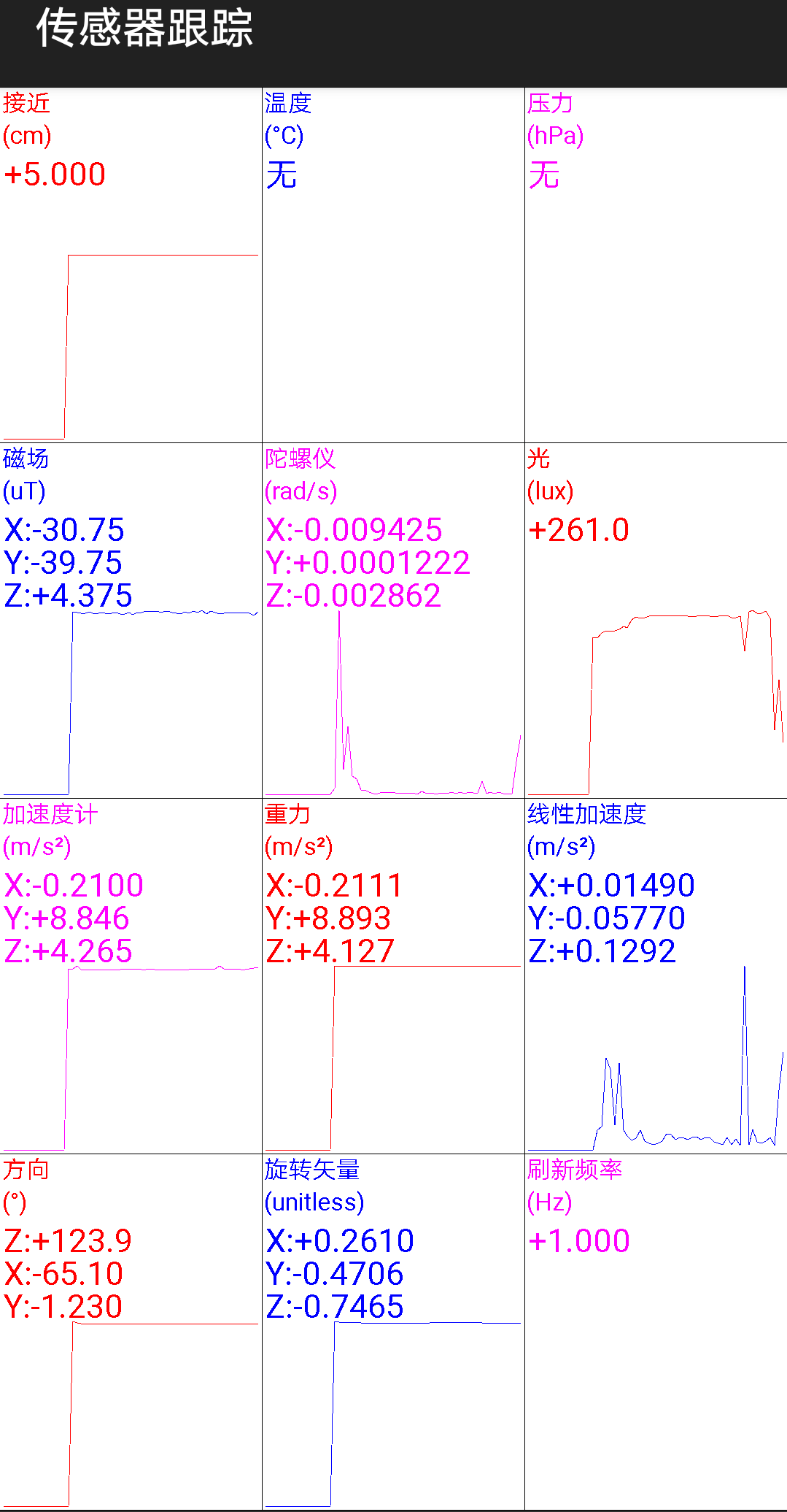
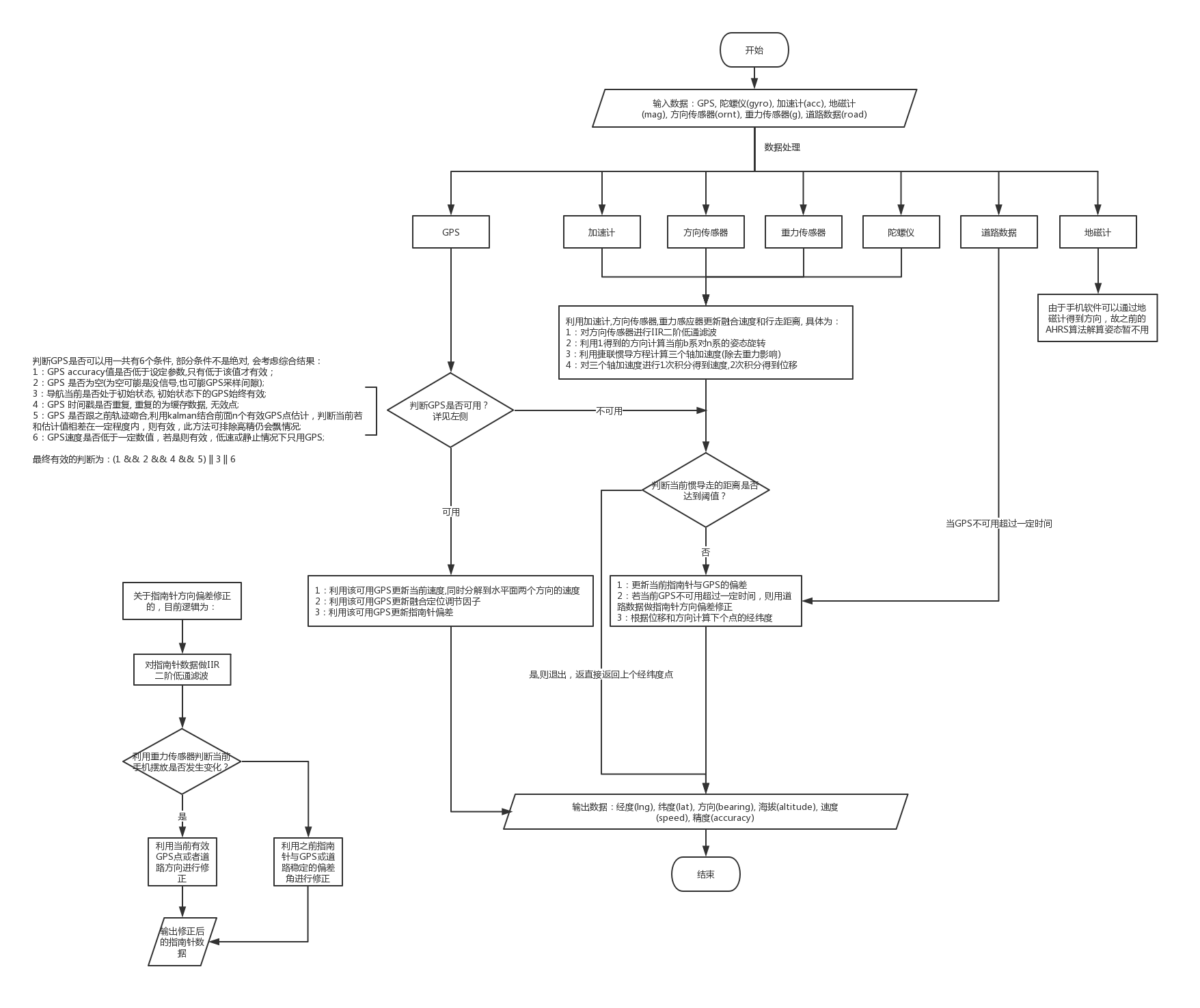
Positioning is the most basic and crucial step in the driving navigation. An accurate positioning can effectively improve the accuracy of the road-binding, and can also sense the change of the driving pattern more accurately. Since the project is mainly based on mobile phones for navigation and positioning, Currently used is the built-in sensor data (gyroscope, accelerometer, geomagnetic meter, direction sensor, gravity sensor) and GPS data fusion positioning.
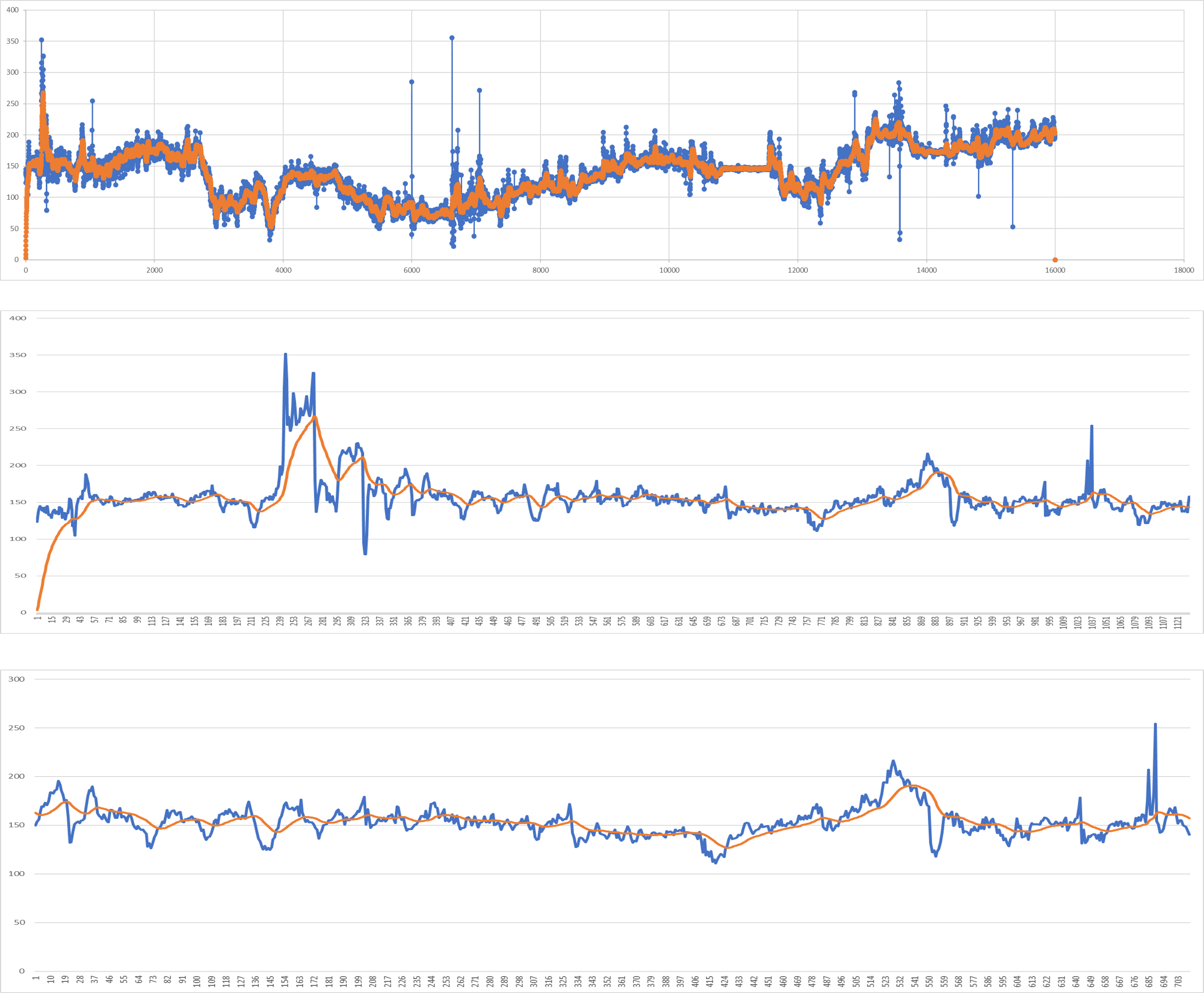
- orientation data filter(Using IIR low pass filter), blue line is the origin data, orange lie is the filter data
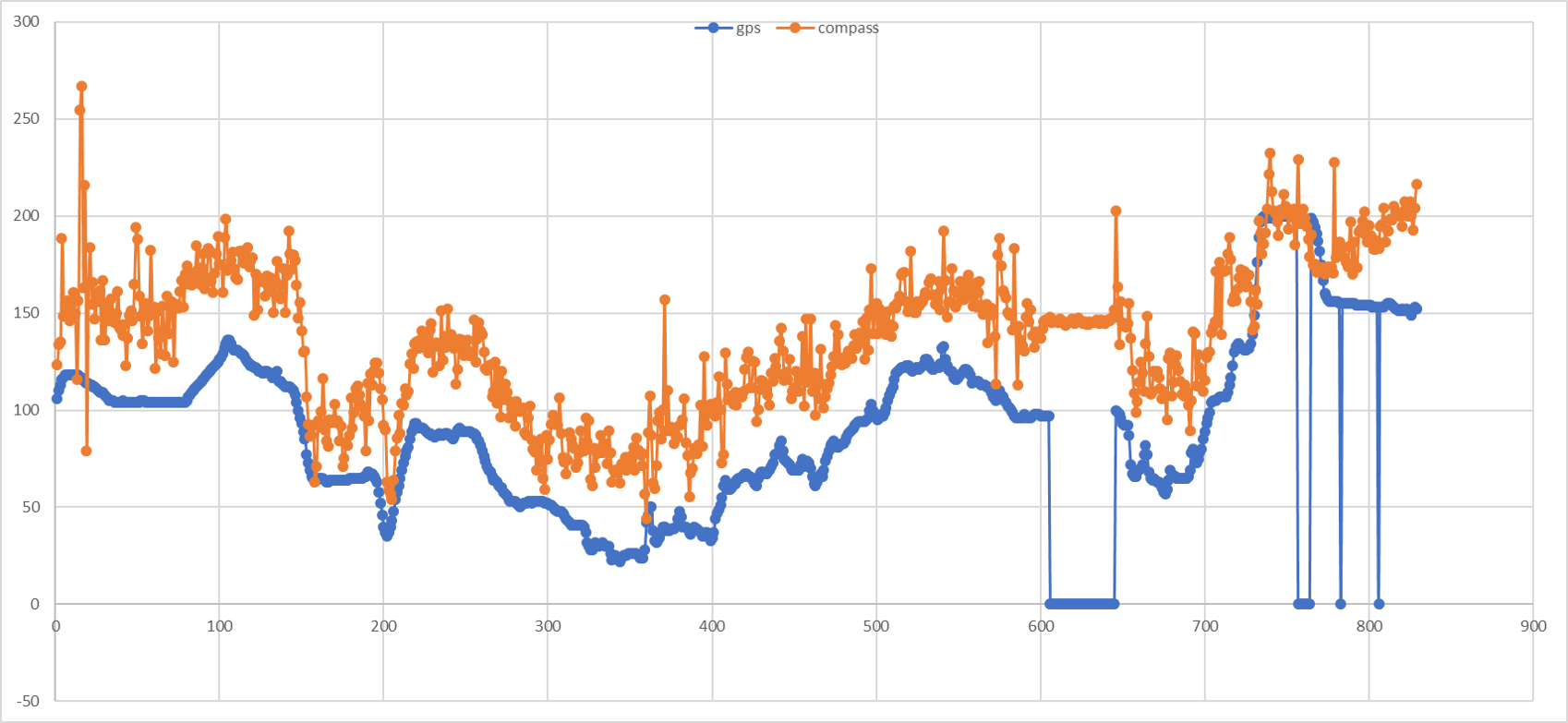
- Because the posture of the smartphone could be arbitrary, so we need the gps bearing and road heading to correct the compass, below show some difference between compass and gps bearing.
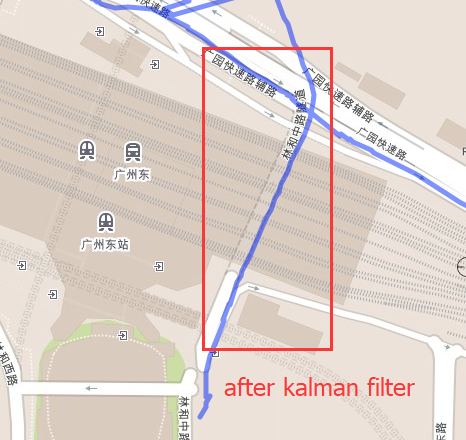
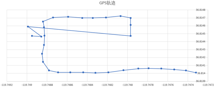
- Some time gps is high accuracy but still drift, using the kalman filter and establish the equation can help to fix this, below show some example that gps drift in tunnel with high accuracy.
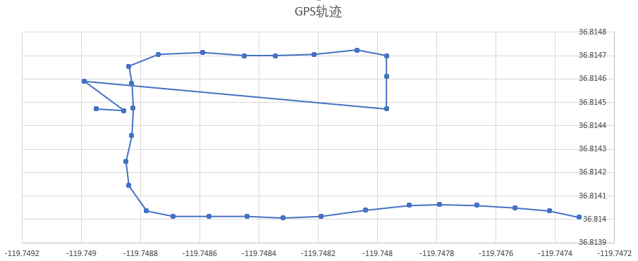
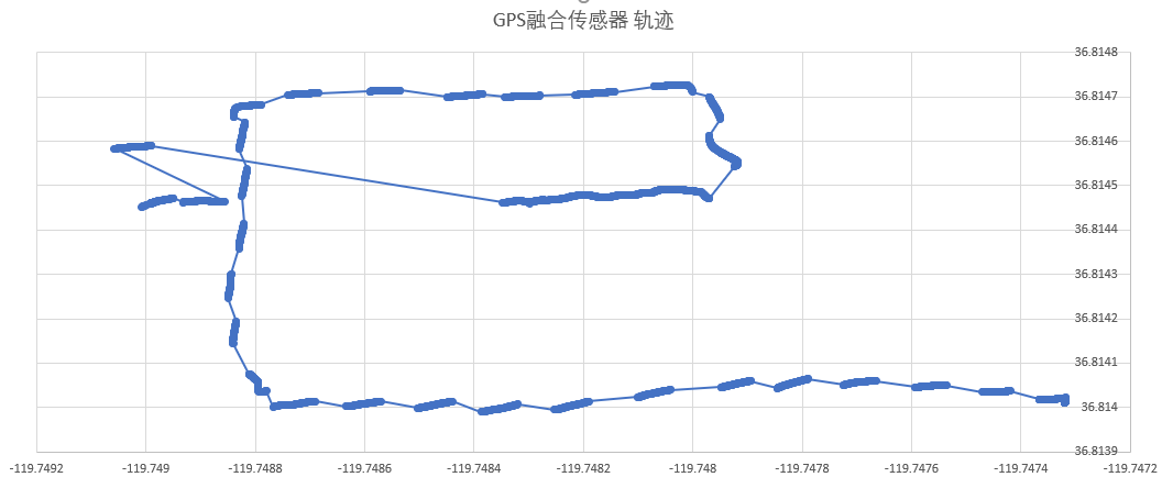
- fusion GPS and INS
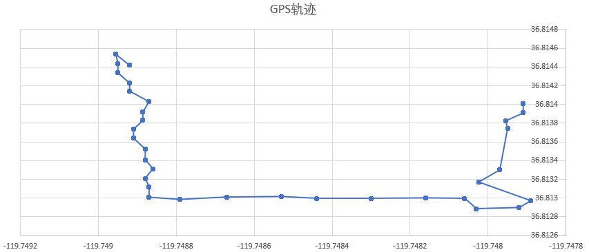
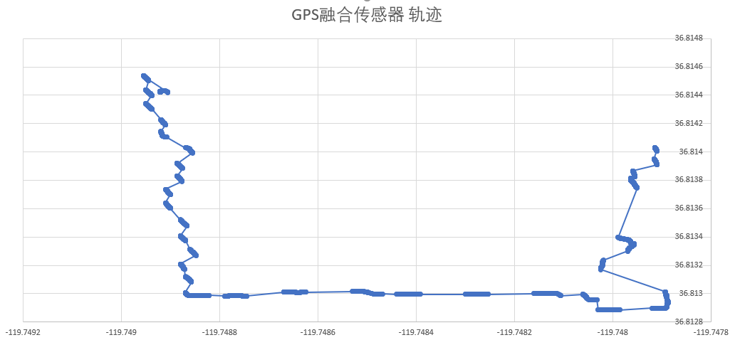
- not fusion GPS and INS

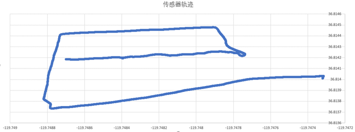
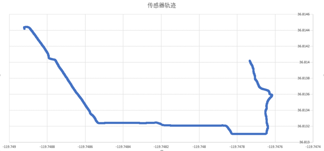
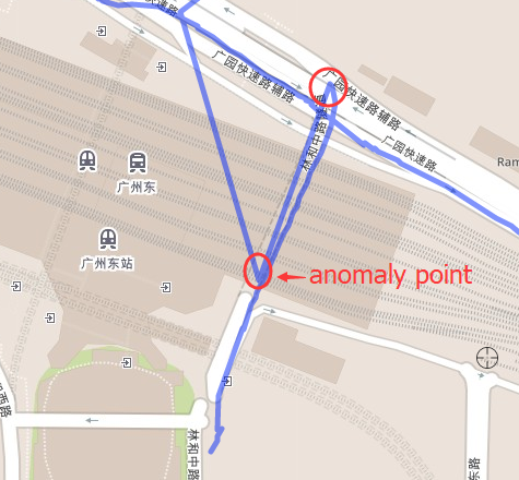
- During the movement, the road is not tied, and GPS is restored after GPS is shielded
- Clean the garbage code.
- Template processing.
- Using smart pointer instead.
- Complete all kinds of documents.
- Add more test case.
- Design a suitable pattern.
- 《惯性导航》秦永元
- 《捷联惯性导航技术(第2版 译本)》译者:张天光/王秀萍/王丽霞 作者:DavidH.Titte
- An efficient orientation filter for inertial and inertial/magnetic sensor arrays
- Estimation of IMU and MARG orientation using a gradient descent algorithm
- Direction Cosine Matrix IMU Theory
- METHODS FOR NON-LINEAR LEAST SQUARES PROBLEMS
- A Calibration Algorithm for Microelectromechanical Systems Accelerometers in Inertial Navigation Sensors
- A Calibration Method of Three-axis Magnetic Sensor Based on Ellipsoid Fitting
- Accuracy Improvement of Low Cost INS/GPS for Land Applications
- Trajectory preprocessing: Computing with Spatial Trajectories
